File #23: "Figure 3"
Title
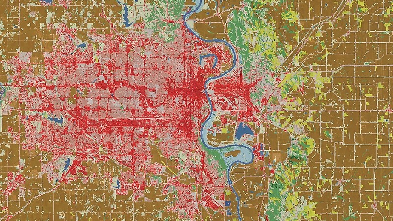
Figure 3
Description
A satellite image of the greater Omaha area. The dark red and pink parts on the map indicate impervious surfaces, meaning that these areas have been paved with concrete, so water is unable penetrate and reach soil. When impervious surfaces are mapped using satellite imagery, the amount of land alteration resulting from concrete usage can be determined along with concrete consumption.
Source
“USGS Small-scale Dataset - 100-Meter Resolution Impervious Surface of the Conterminous United States 201301 TIFF,”U.S. Geological Survey, accessed December 10, 2017, https://catalog.data.gov/dataset/usgs-small-scale-dataset-100-meter-resolution-impervious-surface-of-the-conterminous-united-st.
