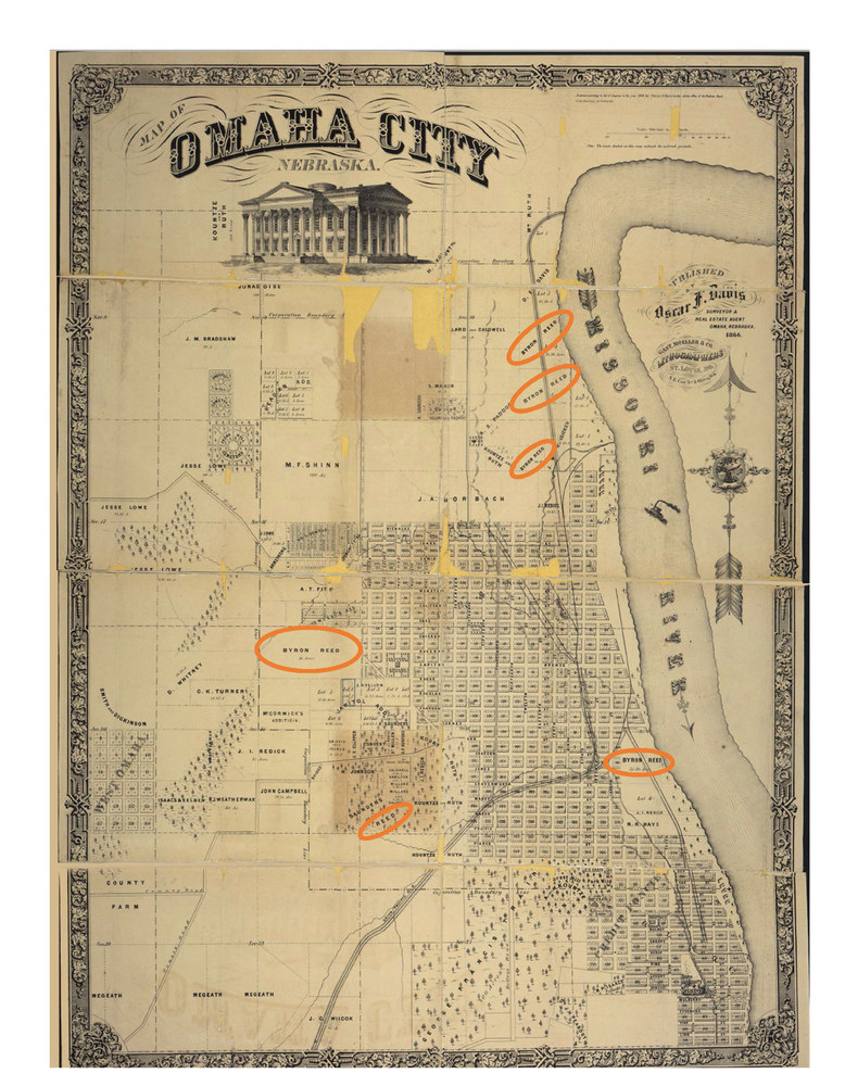
File #86: "Figure 4: 1866 Omaha, Nebraska Land Survey Map"
Title
Figure 4: 1866 Omaha, Nebraska Land Survey Map
Description
Note the several large properties around city limits in Byron Reed’s possession (circled in orange). At this time the Civil War had just concluded, and work on the Union Pacific railroad was accelerating, resulting in much of Reed’s land quickly becoming urbanized. Reed also owns a number of plots within the city in 1866, however, ownership of these lots is not pictured in the graphic.
Source
Image courtesy of Omaha Landmarks Heritage Preservation Commission (https://landmark.cityofomaha.org/maps.)
