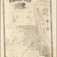
Map of Omaha City, Nebraska
Dublin Core
Title
Map of Omaha City, Nebraska
Subject
Map of Omaha, Nebraska
Description
Map of Omaha, Nebraska in 1866. Taken from the David Rumsey collection, this map shows Omaha 12 years after its incorporation in 1854. Nebraska would go on to become the 37th state in the year following this map's creation.
The hyperlink on this page is a link to an ARCGIS story map with slide bar using this map and comparing it to a 2019 base map for the city of Omaha, Nebraska.
The hyperlink on this page is a link to an ARCGIS story map with slide bar using this map and comparing it to a 2019 base map for the city of Omaha, Nebraska.
Creator
Oscar Davis
Source
David Rumsey
Publisher
Gast, Moeller & Co.
Date
1866
Hyperlink Item Type Metadata
URL
https://arcg.is/005Cay
Citation
Oscar Davis, “Map of Omaha City, Nebraska,” History of Environmental Inequalities, accessed May 6, 2024, https://steppingintothemap.com/inequalities/items/show/35.
Embed
Copy the code below into your web page
