Maps
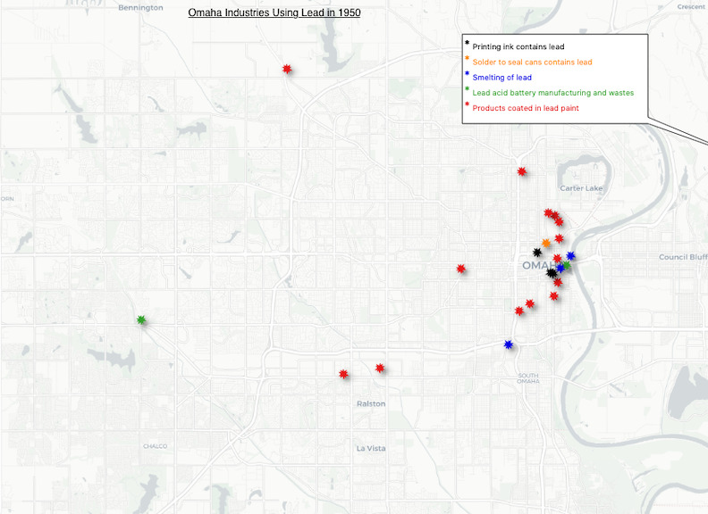
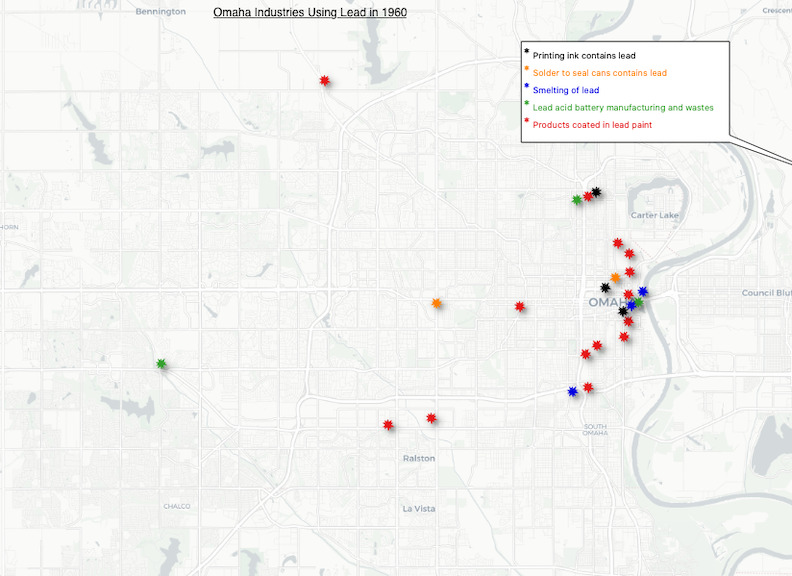
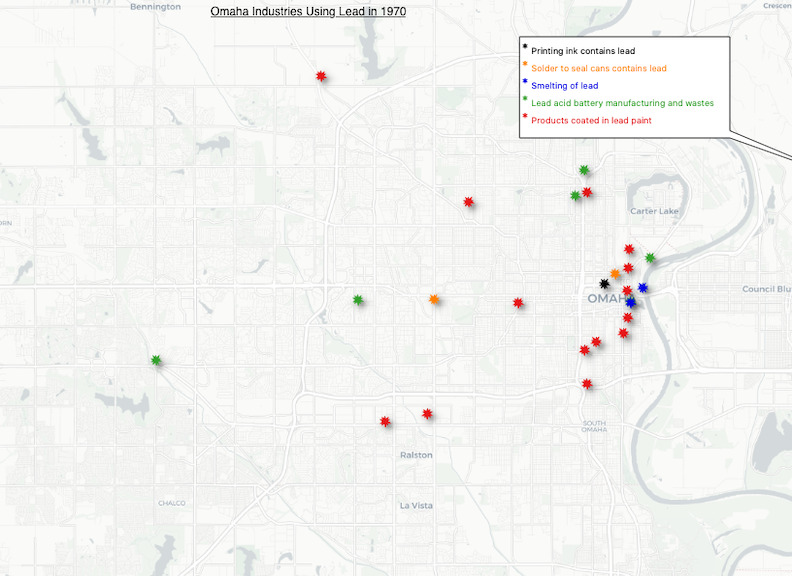
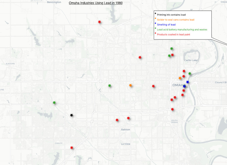
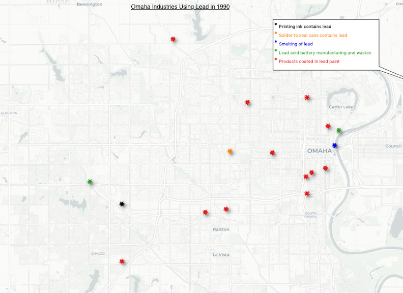
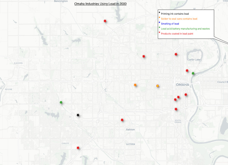
This page includes static maps of the various Omaha businesses using lead in 1950, 1960, 1970, 1980, 1990, and 2000. These maps were created from data the EPA collected on businesses confirmed to have used lead in their products in Omaha during these years. The maps include all of these businesses, aside from a couple whose locations and/or years of operations could not be found.
Our analysis of industrial lead between 1950 and 2000 reveals a few trends. First, we see a very high concentration of businesses using lead in downtown Omaha from 1950 to 1970, almost precisely where today's superfund site is located. Then, we begin to see more expansion of these businesses into West Omaha from 1970 through 1980 as suburbanization takes root. Following trends in the distribution of Omaha's population was strategic for these businesses, as their services were sought out by people living in the suburbs rather than just downtown. Finally, from 1980 to 2000, we see a rapid decline in these businesses in downtown Omaha due in part to increased awareness of the dangers of lead poisoning, as well as new methods of manufacture taking lead's place in industry.
