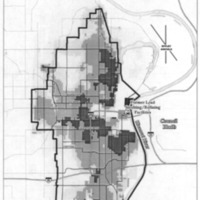
Omaha Lead Site-map-EPA 2009
Dublin Core
Title
Omaha Lead Site-map-EPA 2009
Subject
Maps
Lead
EPA
Omaha
ASARCO
Council Bluffs
Lead
EPA
Omaha
ASARCO
Council Bluffs
Description
Map of Omaha Lead Superfund Site, Omaha, Nebraska. Asarco and other companies had contaminated the site. The map shows average lead concentrations based on soil measurements. EPA was scheduled to complete soil cleanup in over 12,500 Omaha residential yards by December 2015.
Creator
U.S. Environmental Protection Agency (EPA), Kansas City, KS.
Source
"Omaha Lead Site, Operable Unit 02. Final Record of Decision."
Publisher
EPA
Date
13 May 2009
Contributor
Emily Burke & Sean Downey
Rights
Public Domain
Format
Original file (1,516 × 2,218 pixels, file size: 1.51 MB, MIME type: image/png)
Type
Map
Identifier
Document ID 30022233. Figure 1, p. 164.
Still Image Item Type Metadata
Physical Dimensions
Original file (1,516 × 2,218 pixels, file size: 1.51 MB, MIME type: image/png)
Collection
Citation
U.S. Environmental Protection Agency (EPA), Kansas City, KS., “Omaha Lead Site-map-EPA 2009,” History of Environmental Inequalities, accessed April 30, 2024, https://steppingintothemap.com/inequalities/items/show/17.
Embed
Copy the code below into your web page
