2001: EPA Maps the Extent of Lead Contamination
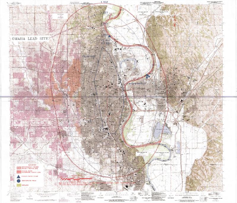
This topographic map, created by the U.S. Environmental Protection Agency (EPA) in 2001, outlines the geographic extent of the Omaha Lead Superfund Site. The shaded area represents neighborhoods identified with hazardous soil lead concentrations following decades of airborne emissions from the Asarco lead refinery and other industrial sources. The image comes from the Final Preliminary Assessment/Site Inspection Report prepared in August 2001 by Black & Veatch Special Projects Corp. for EPA Region VII.
The 2001 report marked a major turning point in Omaha’s remediation history, transitioning from localized and state-managed monitoring to federal recognition and intervention under the Comprehensive Environmental Response, Compensation, and Liability Act (CERCLA). The document detailed how air emissions from the Asarco refinery, which operated from the 1870s until 1997, combined with urban sources such as lead-based paint and vehicle exhaust, had deposited hazardous levels of lead across Omaha’s residential neighborhoods. Soil sampling confirmed widespread contamination above 400 milligrams per kilogram (mg/kg), with the highest levels found in North and East Omaha, areas disproportionately affected by environmental inequities.
By this stage, local health data had already revealed that many children’s blood lead levels exceeded national averages, prompting the Omaha City Council in 1998 to request federal assistance. The 2001 Preliminary Assessment/Site Inspection Report formally defined the boundaries and severity of contamination, identified high-risk populations, and recommended comprehensive cleanup actions. This document directly led to the site’s inclusion on the National Priorities List in 2003, initiating one of the nation’s largest residential lead remediation projects.
From a broader timeline perspective, this report represents the inflection point in Omaha’s long struggle with lead contamination. It captured the moment when environmental advocacy, public health data, and federal policy intersected to transform the city’s response, marking the beginning of large-scale, federally coordinated cleanup efforts that would continue through 2015.
Black & Veatch Special Projects Corp. “Final Preliminary Assessment/Site Inspection Report.” Environmental Protection Agency , U.S Environmental Protection Agency, Region VII, Aug. 2001, semspub.epa.gov/work/07/40051879.pdf