
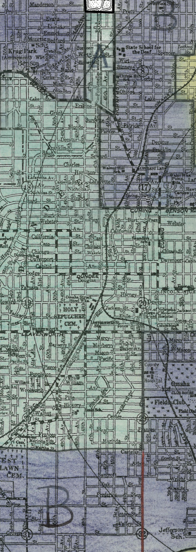
In the Mapping Society – Nationalities, Race and Religion article, it talked about how The United States has segregated certain areas of towns based off of risk ratings, making it very hard for underprivileged people to have the chance to get out. This past summer I worked at a smaller bank in Dundee (Here in Omaha) on the lending side of operations. We had many clients in the Omaha area, mostly in the C areas, and a little in D areas that I have pictured below. Often times, I would be tasked with going to access the properties in these areas, and all I could think about is, “how could these people possibly make it out of this area?”
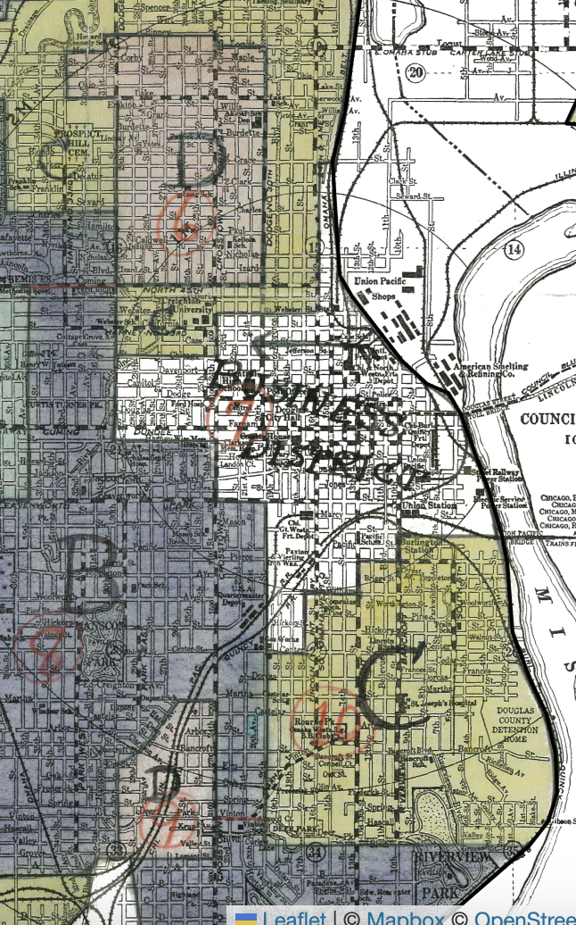
Likewise, we had a smaller amount of clients listed in the A and B areas towards the western part of Omaha. When looking at these properties, all you can think is ” wow, these people have it nice.”
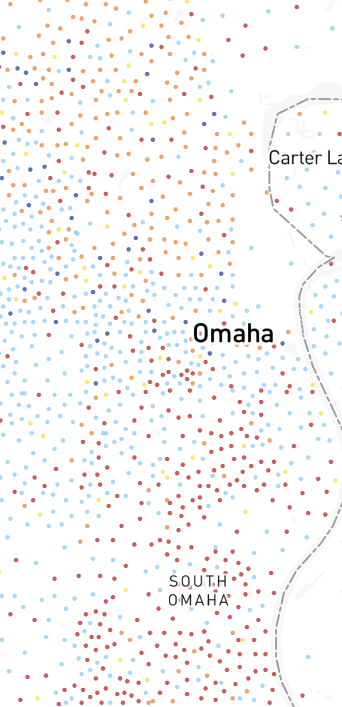
The bottom line is that because of our nations past, many cities across the United States have created boundaries that are almost impossible for people to move out of. Becuase of this past, we are stuck with segregated communities that you can see on the map below of the North being comprised of mostly Black, the South being comprised of mostly Hispanic, and the West being comprised of mostly White.
What a unique opportunity to see the impacts/legacy of redlining up close. What do you think enforces this continued segregation?