This map is a reference map proposing where subterranean geologic strata are located under England, Wales, and southern Scotland.
Usability was a clearly a key concern for William Smith in creating this map. The legend Smith included on the 1828 version of this map named each stratum, described the rocks present in each stratum, and assigned each stratum a color on the map. Most entries also included examples of topography made of each stratum.
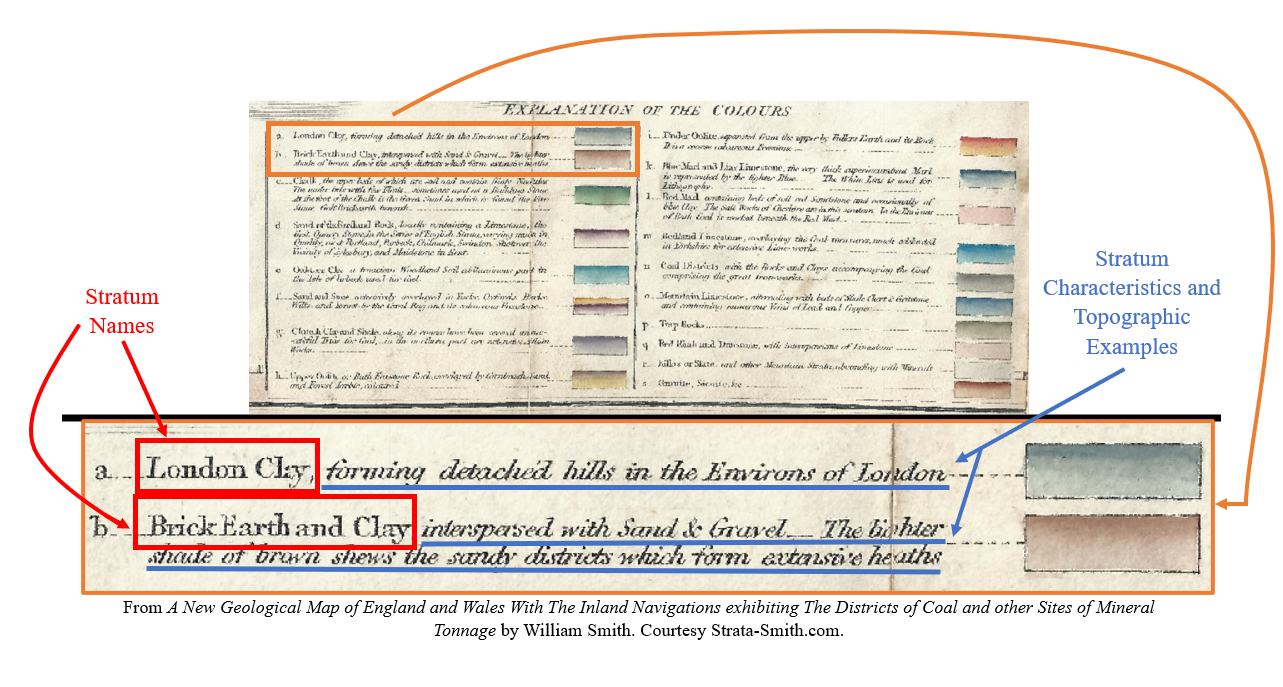
With this detailed legend, a reader can easily identify specific strata on the map. This makes this map a highly effective reference map as a new reader can quickly and easily find information they are looking for anywhere on the map.
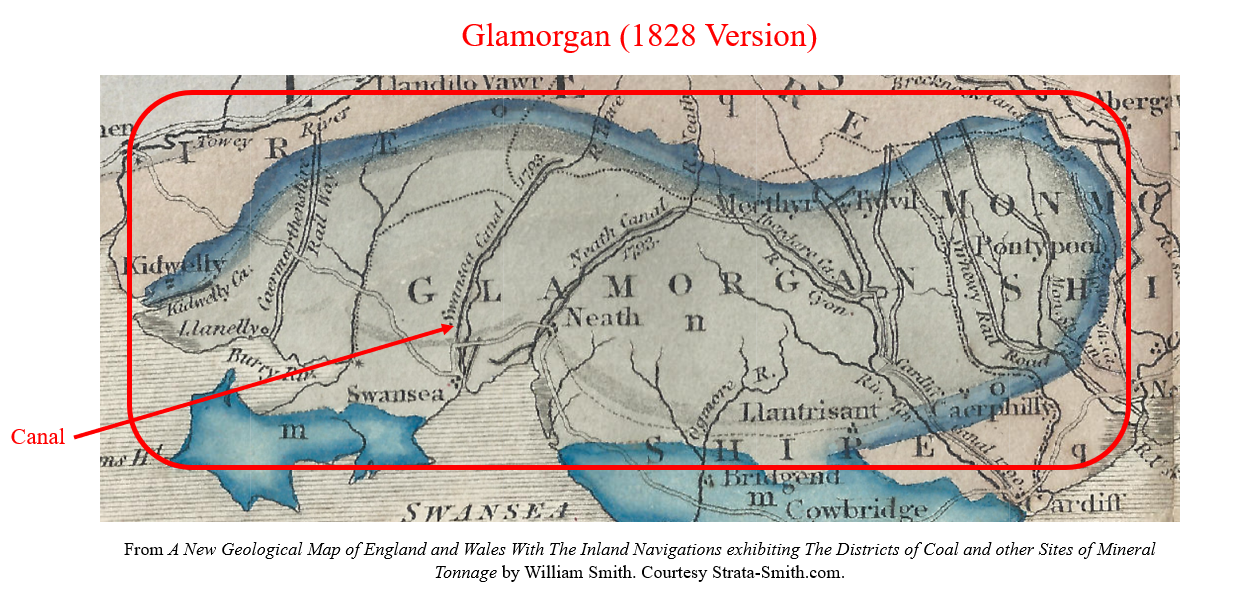
Between the 1815 and 1828 versions of his map, Smith dramatically improved the map’s usability by changing the color of several strata to make it easier for the reader to identify canals and other secondary features. One example is the change Smith made to the color of the stratum under Glamorgan in southern Wales. In the 1815 version of the map, Smith colored this stratum black with heavy shading around the edges. . .
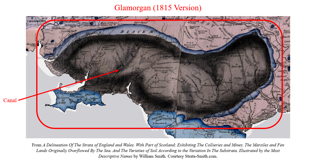
. . . while in the 1828 version, Smith colored the same stratum light green, making canals and other landmarks easier to identify.
Nineteenth-century science played a role in Smith’s mapmaking by enabling him to accurately differentiate seemingly identical strata, making it possible for him to create this map. In his book The Map That Changed The World: William Smith and the Birth of Modern Geology, Simon Winchester describes how Smith discovered that seemingly identical strata could be differentiated by analyzing the subtle differences of the fossils they contained. [1] This gave Smith the proper tools and knowledge to effectively create his geologic map of Britain.
As described in an article chronicling William Smith and his work from NASA’s Earth Observatory, Smith “grew up when the Industrial Revolution focused England’s attention on [. . .] coal.” [2] This led Smith to work as a coal mine and canal surveyor, professions that allowed him to observe geologic strata across Britain and lent focus to his mapmaking. [2] Smith likely created his geologic maps to “accurately order rock layers and to help coal prospectors identify the best places to dig,” priorities that pushed him to make his maps easily usable for the coal industry. [2]
[1] Simon Winchester, The Map That Changed The World: William Smith and the Birth of Modern Geology, 1st ed. (New York: HarperCollins, 2001), 117-119.
[2] Michon Scott, “William Smith (1769-1839),” NASA Earth Observatory, NASA, May 8, 2008, https://earthobservatory.nasa.gov/features/WilliamSmith.
Map Citations (In order of appearance):
William Smith, A New Geological Map of England and Wales With The Inland Navigations exhibiting The Districts of Coal and other Sites of Mineral Tonnage, 1828, “William Smith’s Maps – Interactive,” http://www.strata-smith.com/map/, (accessed January 28, 2024).
William Smith, A Delineation Of The Strata of England and Wales. With Part of Scotland; Exhibiting The Collieries and Mines. The Marsiles and Fen Lands Originally Overflowed By The Sea. And The Varieties of Soil According to the Variation In The Substrata. Illustrated by the Most Descriptive Names, 1828, “William Smith’s Maps – Interactive,” http://www.strata-smith.com/map/, (accessed January 28, 2024).