
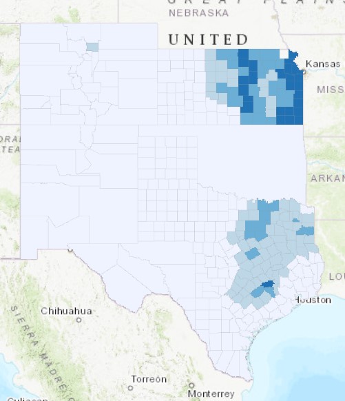
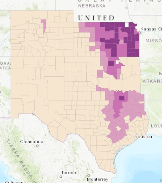
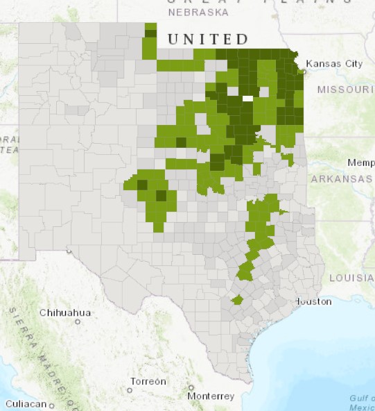
One key change that I noticed on these three maps is the continued westward expansion of more extensive farming and cultivation. For example, in Kansas, between 1880 and 1940, counties in central Kansas went from having little of their land cultivated, to having a large percentage of it in use for intensive farming. This makes sense as throughout this time, as Geoff Cunfer pointed out in his book On the Great Plains: Agriculture and Environment, more extensive cultivation of the Great Plains expanded west as white farmers established farms further west and began to plow and cultivate the land.
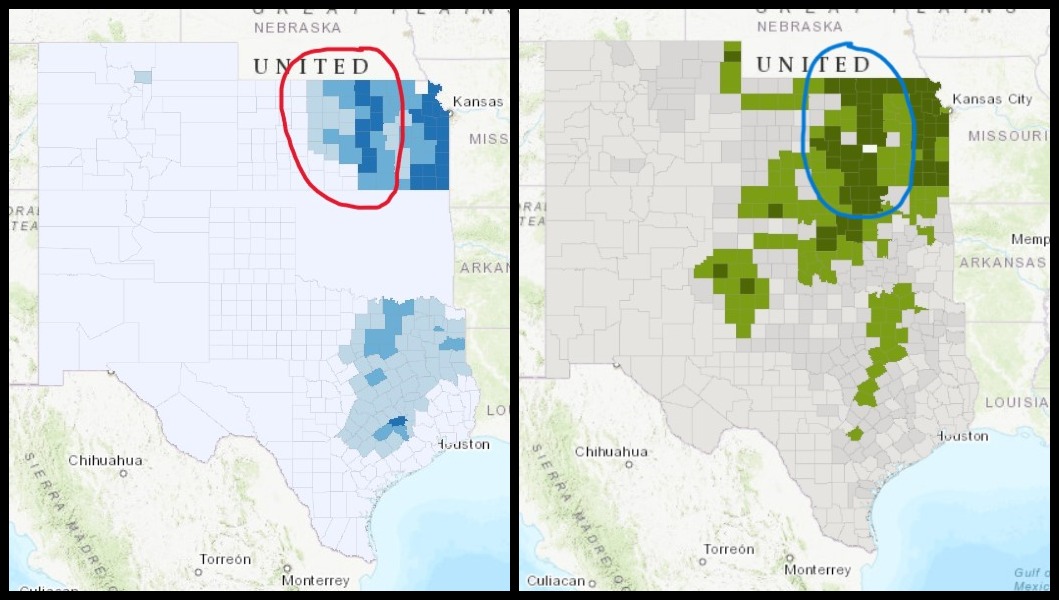
Another important change across these three maps is the explosion of cultivated land in Oklahoma. In 1880, farmers were only cultivating a very low percentage of land in Oklahoma. In 1900 a significant percentage of land in north-central Oklahoma was being cultivated, while in 1940 large percentages of land were under cultivation all across the state. I would attribute this to increases in white settlement in Oklahoma between 1880 and 1940. The United States Government forced many Native American tribes to migrate to what is now Oklahoma as they expelled them from their tribal lands further east. As more land came to be bought up and cultivated by other white settlers on the Great Plains, many white settlers likely turned to settling and cultivating land in Oklahoma in and around lands inhabited by forcibly relocated Native American tribes.
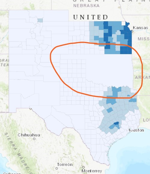

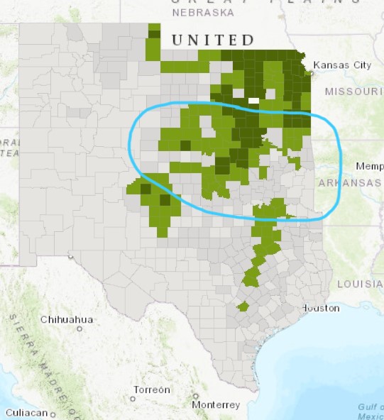
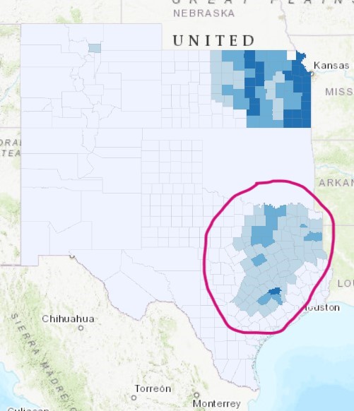
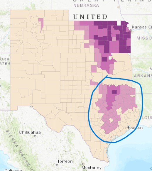
A third important change I noticed across the time period these three maps represent is the dramatic reduction in the percent of land cultivated in many counties in northeastern Texas. In 1880 and 1900 there was a relatively large number of counties in northeastern Texas that had a substantial percentage of their land under cultivation. However, by 1940 much of this land was apparently no longer cultivated, with only a single band of counties with high percentages of cultivation across northeastern and central Texas remaining. I believe this was likely due to farmers plowing and cultivating past the what those areas of Texas could support agriculturally, something Geoff Cunfer pointed out occurred in his case study of Rooks County, Kansas and across most of the Great Plains. As a result of pushing just past the natural boundaries of the northeastern Texas, most farmers had to reduce the amount of land they cultivated substantially. On the other hand, farmers in the band of counties crossing northeastern and central Texas found they could expand the amount of land they cultivated as it was within the natural capacity of their area.

Nicely done!