
The Outline Map of Chase Co. Kansas. 1901 was created to attempt to increase settlement in the county in the southeast quadrant of the state. The scan of the map that was provided even contains a stamp of the Warren Mortgage Company seen below. The map’s purpose is to enable and convince people to settle in Kansas in the early 20th century, and holds little mention of the difficulties that may arise while attempting to cultivate the land.
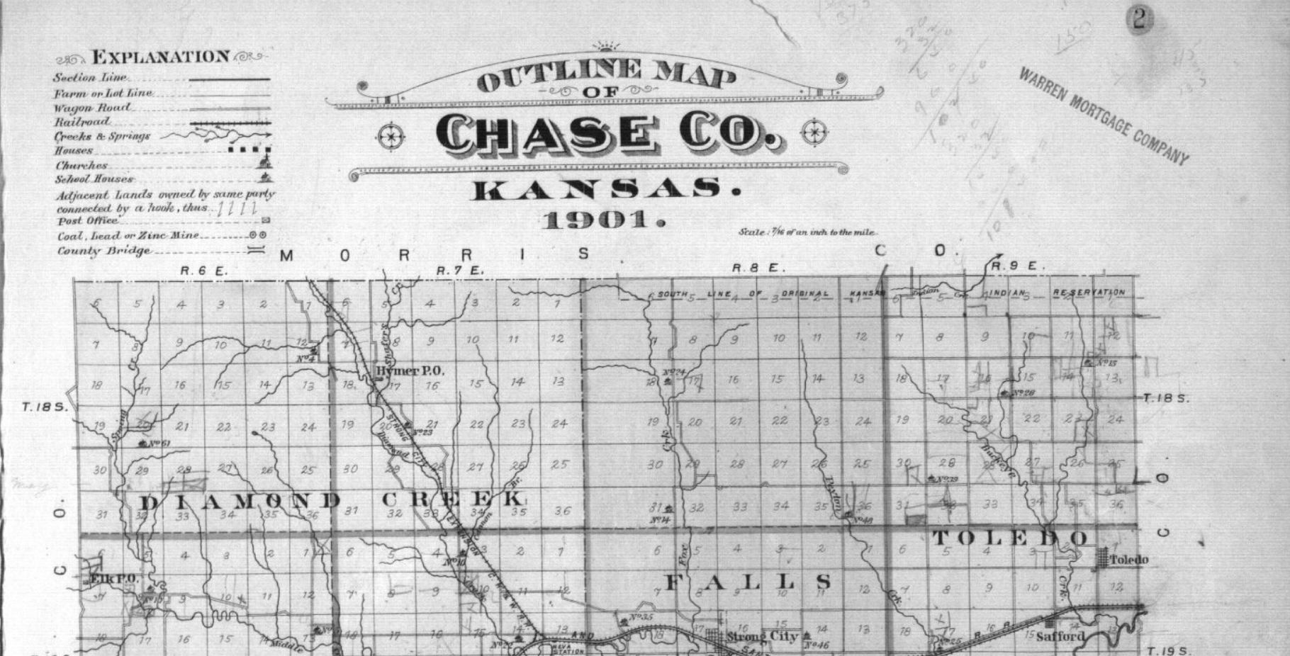
This massively incomplete mapping interpretation of the prairie misinformed those who purchased plots of land, setting them up for failure. Those who purchased land in the great planes were ill equipped to farm in the region due to a shortage of information on the soil types and farming techniques that should be used. The quick sale of these and other similar plots of land in conjunction with lackluster information on how to farm the land likely aided in the severity of the Dust Bowl within Kansas a few decades after the creation of the map.
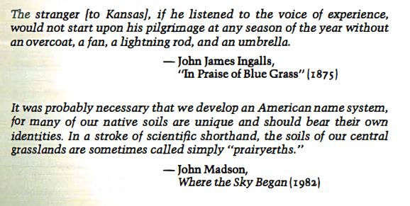
Although this type of map is important for the sale of land it lacks the fundamental understanding of the climate and soil needed for farmers to succeed in the region. William Least Heat-Moon created a more helpful sort of scientific historical collage map consisting of information provided by many different sources. This information was made available at different times, some of which was available before the 1901 map was created, but much of it was not. Although this information was publicly available, it was not all in one place. For example, these two quotes on the first page of the written map would have allowed for a more complete understanding of the gumption needed to cultivate land in Kansas.
Heat-Moon’s approach to mapping portrays a more complete view of the world through the combination of multiple sources. This provides an in-depth understanding of the climate and soil of southeastern Kansas that is difficult to convey to someone that has never been there. Overall, I feel as if Heat-Moon’s approach to mapping Chase County Kansas can be applied broadly to many parts of the great state. Had a map of this approach been available to potential settlers it certainly would have made them aware of the challenges they were going to undergo. This more complete and robust mapping attempt could have been helpful to settlers and reduced improper farming practices throughout the state of Kansas.
This is a nice first post Evan. Its descriptive (even argumentative at times) and makes use of evidence from two (of the three) materials this week. Naturally, make use of all of them for future posts.
I like that you’re tying the plat map to the Dust Bowl, though I’m not sure how “useful” a deep map would really be for agricultural purposes. As you and other rightly noted in the discussion today, these deep maps aren’t super useful for getting around – that’s not their purpose. Still – this is a good first step!
Don’t forget to categorize your posts!