
The maps of the changes to the grasslands of the Great Plains demonstrate a mapping of the changing tension between humans and nature, and how that tension has developed with an influx of people and the creation of new technology within the last century and a half.
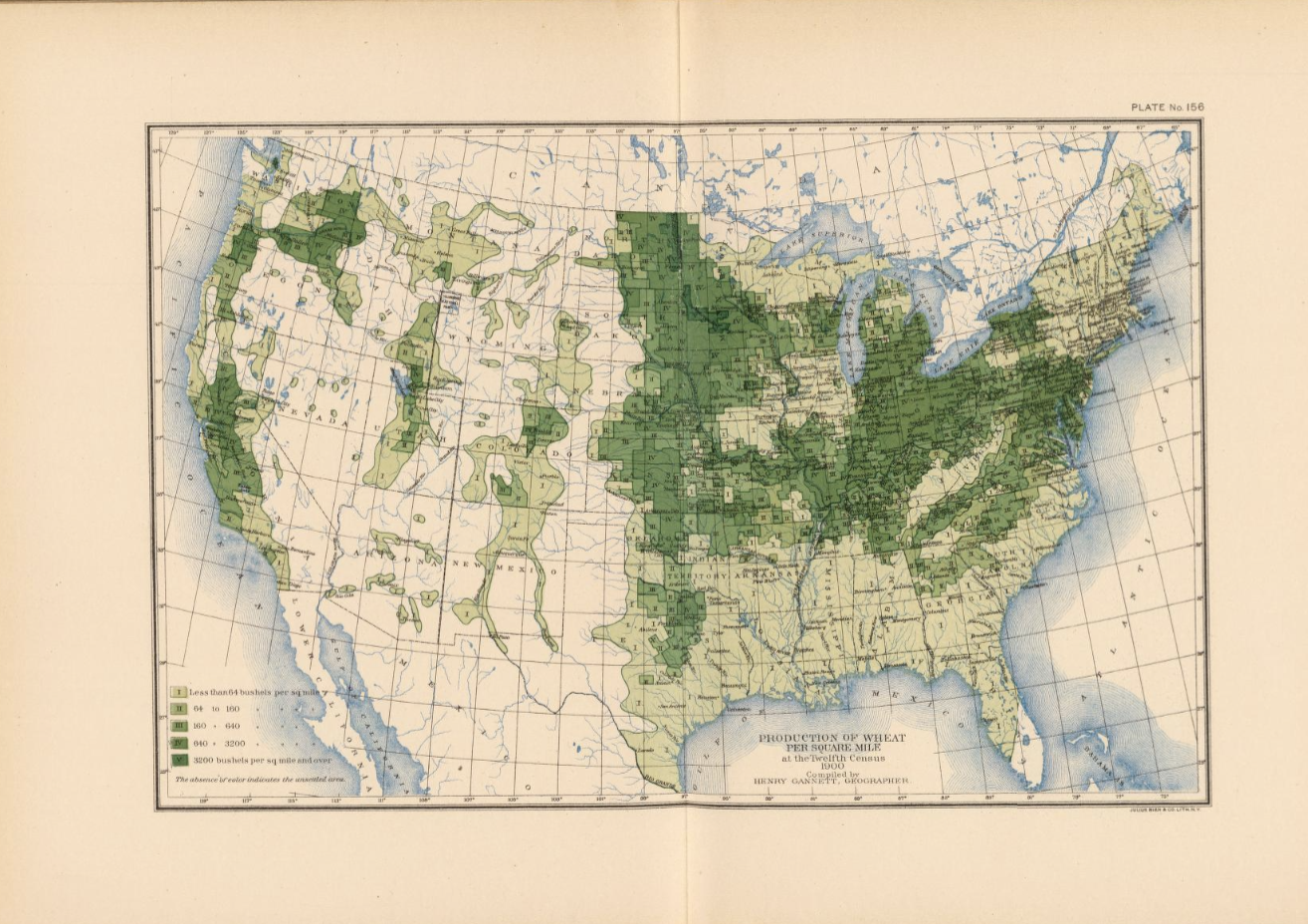
Henry Gannett’s map, 156. wheat/sq. mile, demonstrates the tension between humans and nature in 1903. In the western part of states like North Dakota, South Dakota, and Nebraska, there is a clear divide between land that is used for farming and land that is not. Geoff Cunfer explains several reasons for this task. Firstly, plowing the land to make the Great Plains suitable for farming was a slow task, taking decades for just one family’s farm to be plowed to a level that satisfied them (Cunfer, 18). The other, is that some land was not suitable for farming, even after being plowed – causing it to be turned back over and used for range land. There is a limit to human use of the land. This is a tension between nature and humans. Humans are attempting to exploit an ecological niche with technology, but nature can be unpredictable. Rain, rocks, elevation, and many other factors battled farmers from transforming the grasslands.
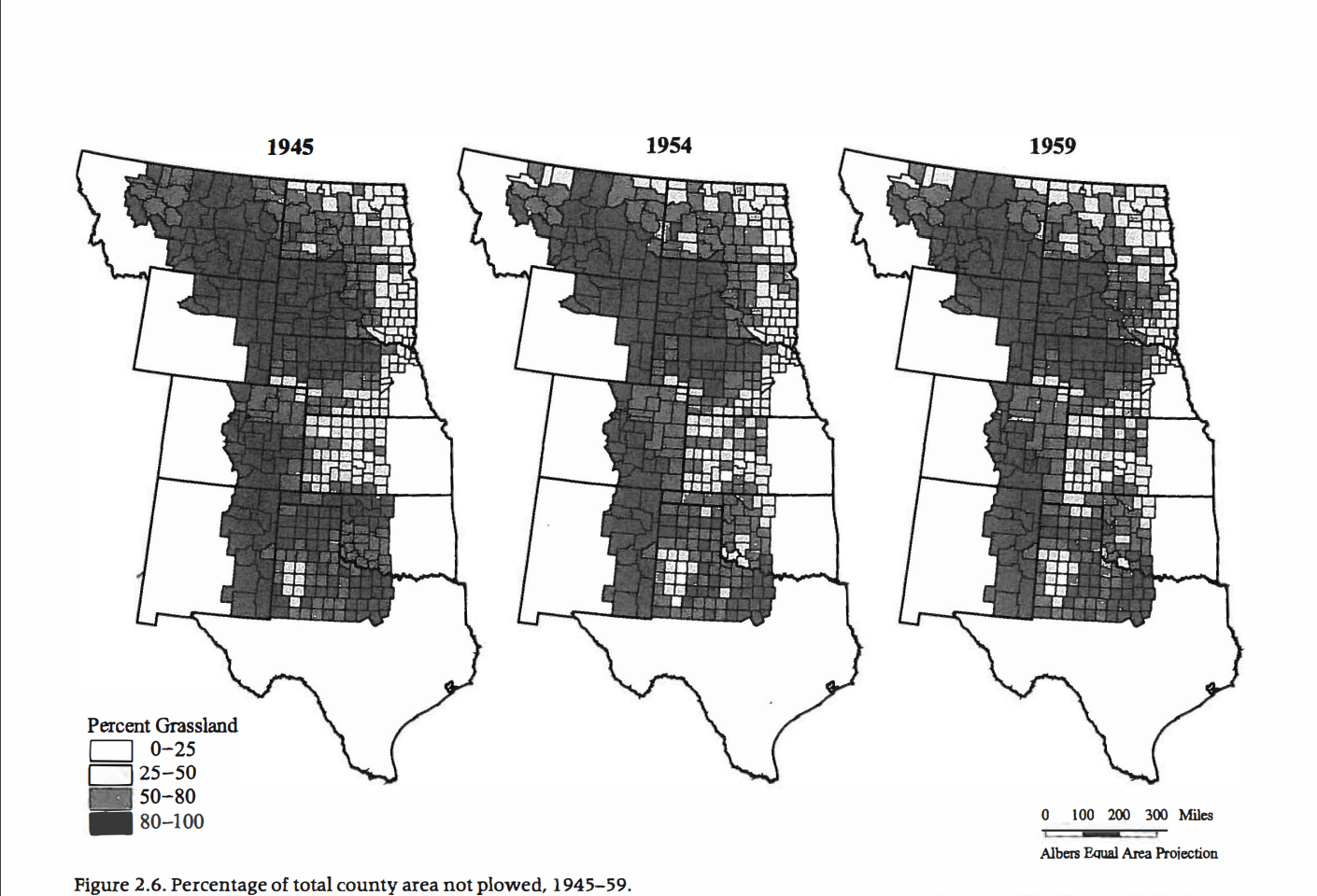

Cunfer’s figures continue to demonstrate the ever-changing tension between nature and humans. Humans have continued to attempt to turn the grasslands into something else, with the mapped divide from Gannett slowly being reduced throughout the decades. To do this, they utilized new tools, technologies, and techniques to better develop and maintain land for their needs. However, tensions between humans and nature come from several different sources, such as carrying capacity, natural resources available, suitable environments to live in, and the ability to successfully apply tools and technology to a sustainable development of land. What are the consequences from increasing the tension between nature and humans?
One example of disaster occurring from increasing the tension between humans and nature is actually one that occurred in the very region being mapped. This was the Dust Bowl of the 1930s. Humans experienced natural consequences of nature, like drought and poor production and decided to overproduce suboptimal land with new machinery (increasing tension). The drought and production caused soil erosion, which would plague the area in dust storms for a decade (further demonstrating the result of too much increased tension between humans and nature).
Bibliography
Cunfer, Geoff. 2005. On the great plains. Texas A&M University Press, pp. 16-37.
National Drought Mitigation Center. “The Dust Bowl.” University of Nebraska. https://drought.unl.edu/dustbowl/#:~:text=Due%20to%20low%20crop%20prices,would%20cause%20the%20Dust%20Bowl.
Gannett, Henry. 1903. “Production of Wheat per Square Mile at the Twelfth Census 1900.” DavidRumsey.com.
Wonderful use of a theme – the “tension” between people and nature – to lend your blog post greater definition. Nicely written and argued!