
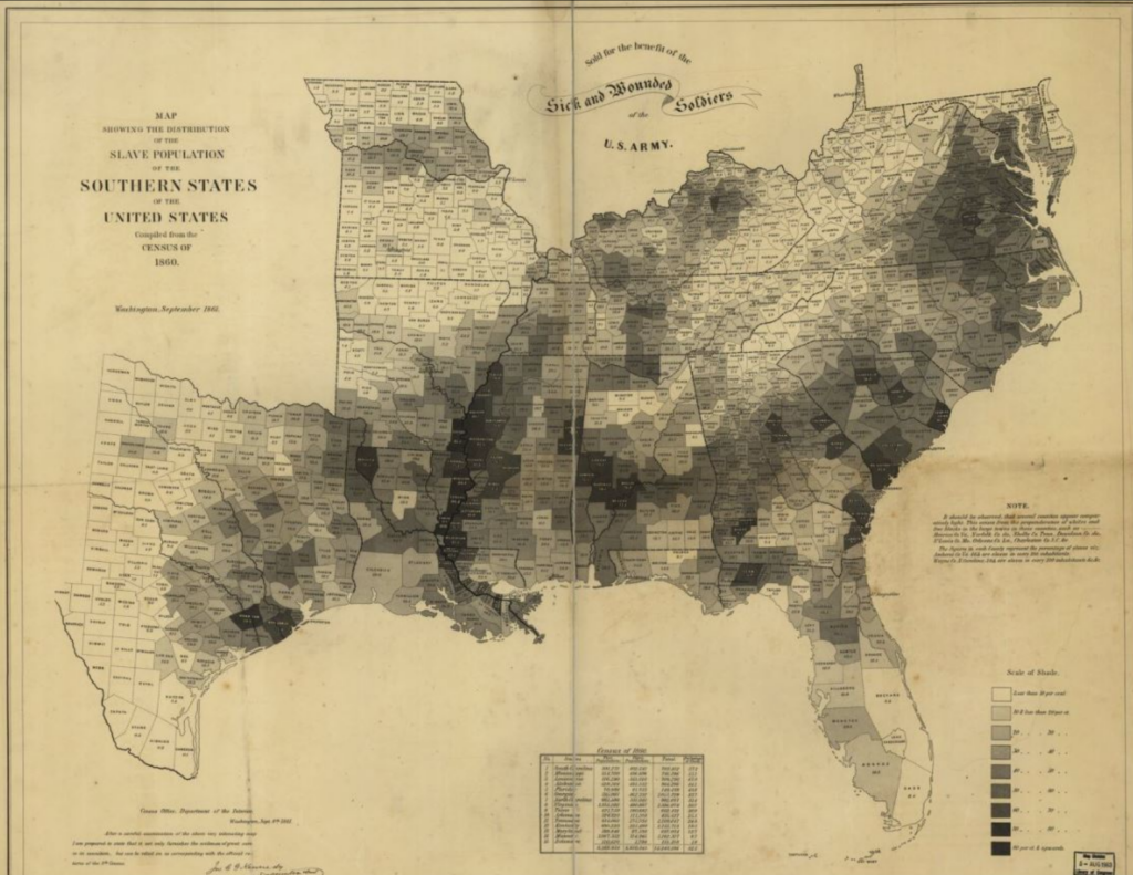
Hergesheimer, Edwin. Map Showing the Distribution of the Slave Population of the Southern States of the United States. Compiled from the Census of 1860.
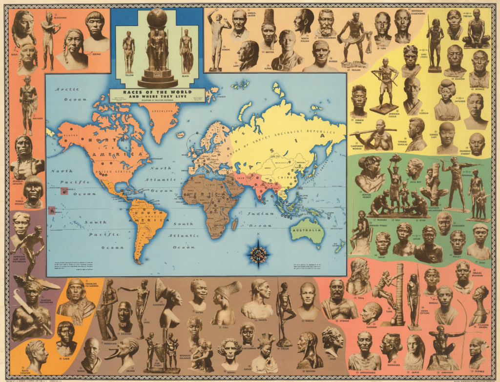
Hoffman, Malvina. Races of the World and Where they Live.
Who were these two maps made for? Is data in a void of its own, objective? Yes. Are the eyes and minds it is made and consumed by objective? No. The dominant way of interpreting data does not mean it is by any means ‘objective’. Factors such as the reason(s) for its collection and compiling by its creator, the interest(s) its existence is then used to serve, down to how each of its observers choose to interpret it are not objective.
Edwin Hergesheimer’s distribution map of the slave population inside Southern States is objectively, just that. Setting this map inside the context of the year it was published, 1861, its importance to this time period is revealed, coinciding with the start of the civil war. This map was used to develop important battle strategies to the Union in this war that would knock out much of the South’s economic infrastructure (reflected in map) and lead to their eventual victory in 1865. The meaning of this map has become deeply attached to the civil war because of this use it served.
In a similar way, Malvina Hoffman’s pictoral map of the races of the world and where they live is objectively true. What matters here, however, is how this information was used in that time period. These sculptures were commissioned by the Field Museum of Chicago in 1933 and put up on display in 1941.
During the early twentieth century geographers and geographical institutions such as the American Geographical Society (AGS) played a significant role in promoting racial and eugenicist views.
– Crampton, pg. 1932
This small detail was not a coincidence. In this era fields such as anthropology and archaeology could have been considered subsections of ‘the science of eugenics’. A science that would only become largely condemned after the rise and downfall of the Nazi party in Germany, but had strong roots in Western, including American, scholarly institutions since the 1860’s.
The efforts of Hoffman were not done with malicious intent, but the intentions of the artist will not always steer their creations to be seen in the light they desired to be seen in. In the modern day, fifty of Hoffman’s works have been put back up on display, many now with their names attached to their statues, which stand as memorializatoins of their existance and not as their undoing.
Leah R. Keith
Hoffman, Malvina. Races of the World and Where they Live
Hergesheimer, Edwin. Map Showing the Distribution of the Slave Population of the Southern states of the United States. Compiled from the census of 1860
Crampton. "Maps and the Social Construction of Race" from the History of Cartography Project (2008), pgs. 1232-1237
Looking at Ourselves, Rethinking the Sculptures of Malvina Hoffman
Another nice post, albeit late. Whether or not the statues of the races is “true” is pretty debatable, but I take your larger point, which is right on the mark.