
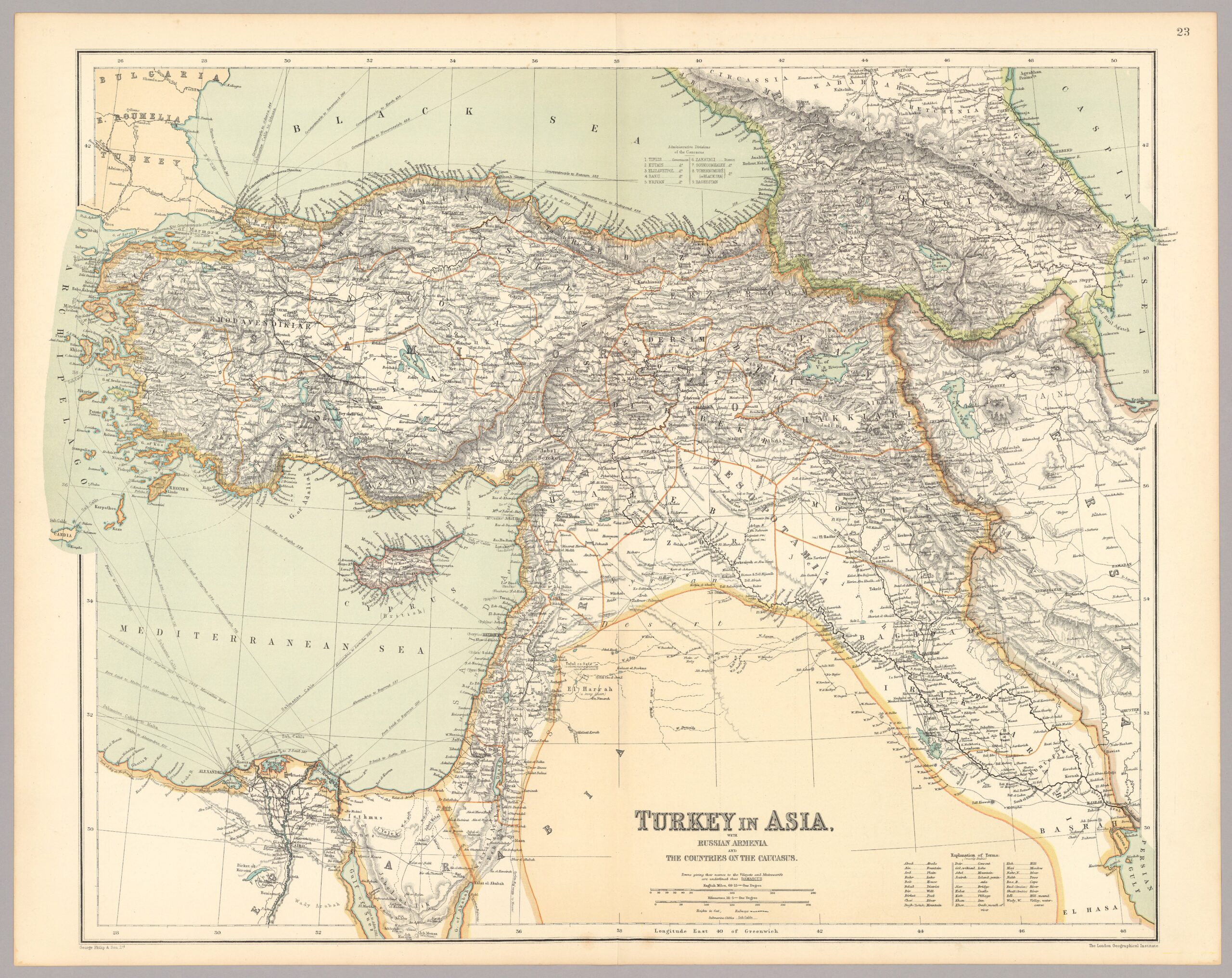
The above map titled ‘Turkey in Asia’ is part of a World Atlas published in 1910 by George Philip & Son Ltd. in London. This company was widely recognized for their precision and attention to detail, something that can still be easily confirmed still today. Through the process of layering this map over one created with satellite-imaging, I learned a lot about this pictured land and its relationship to time through their prominent differences.
Final Georeferenced Result
- How might you use this georeferenced image to uncover new information about the history of the region you just mapped.
Through the creation of this georeferenced map of Asia minor, I placed many pins on big cities in different regions and cities close to the coast and periphery of Philip’s map to make sure they alighned with one another. Sometimes though, the capitols of these different regions no longer existed. This map was made right before the start of WWI, and Turkey has undergone many other internal and external conflicts outside of the world wars since the publication of this map. Even this now empty land where a bustling city used to be, this land that’s become overgrown with plants and wildlife since these people’s departure is evidence that can be used to give context to the history of this region. Although the absence of this information can be seen as an unfortunate and unnecessary loss, it’s amazing that even a significant lack of information can be utilized to further understand the context and time this ghost of a city existed within.
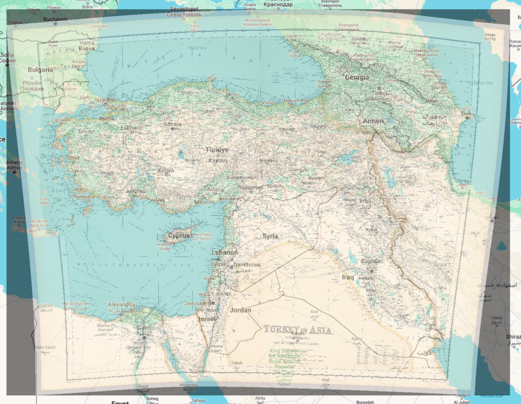
First Georeferenced Result
- What are some weaknesses to this approach? Are there inaccuracies? Do some places map better than others? Why?
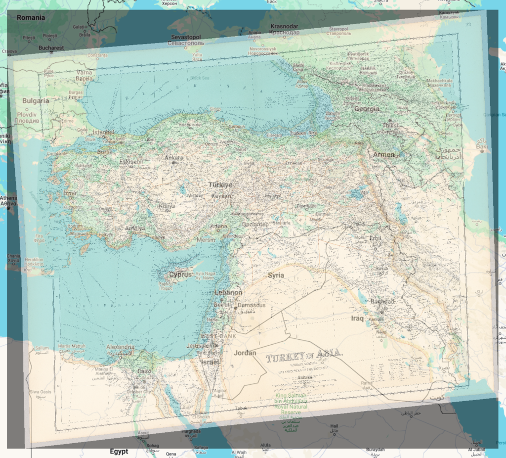
The above is the first georeferenced map I made. It had 8 points placed without much understanding of what their purpose was and it was bad. The final version, however, I took what I learned with this map and placed 19 points strategically, it’s still not perfect though, obviously, and this is where I think some possible inaccuracies could sprout from. The missing cities I spoke on in the previous paragraph existed, but there were times where I found one I thought was missing, but it turns out it had just changed its name, or because of the inaccuracies in my geomapping it had changed positions quite dramatically. I think that gridded maps, like the one we previously worked with on Omaha, would be much easier to map in this situation because you could simply place a grid on each intersection or prominent unmoved landmark. When it came to geomapping a land as large as Turkey, I found that the flow of rivers change, the ocean recedes or rises, and capitols rise and fall. The impermanence of all of these things though definitely made this assignment much more difficult for me.
Nicely done. Glad you went to the trouble of improving your approach!