
1. Are there any features on your historical map that would have been difficult to assign a vector categorization (point, line, polygon)? Why?
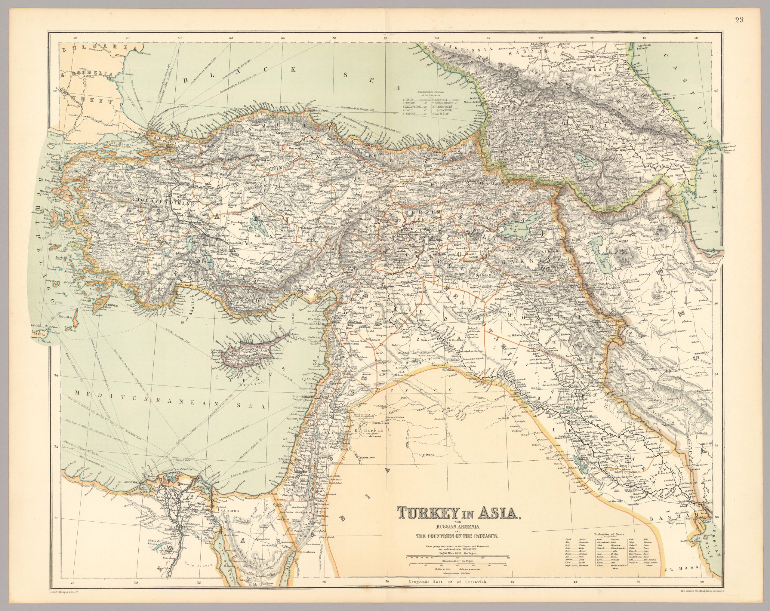
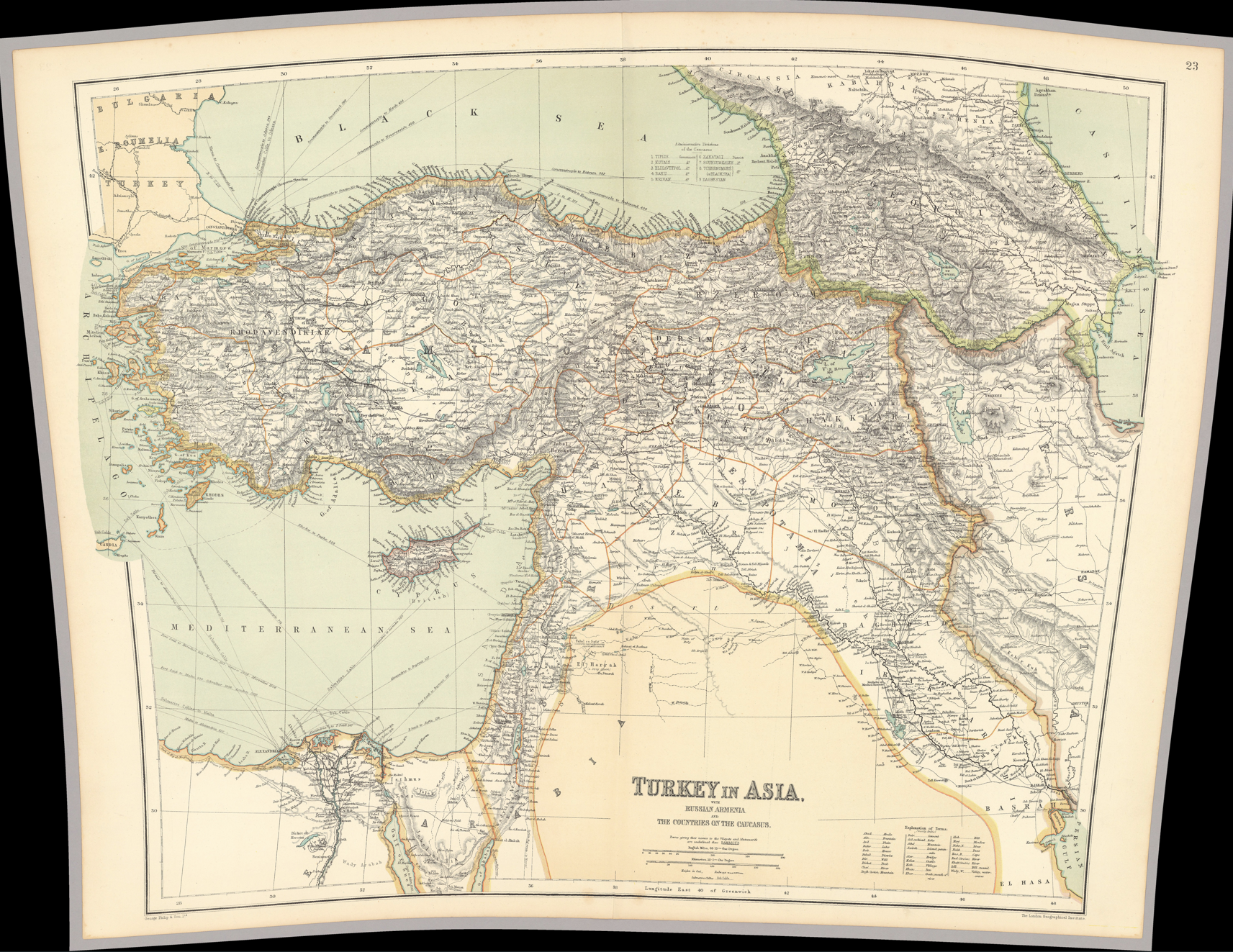
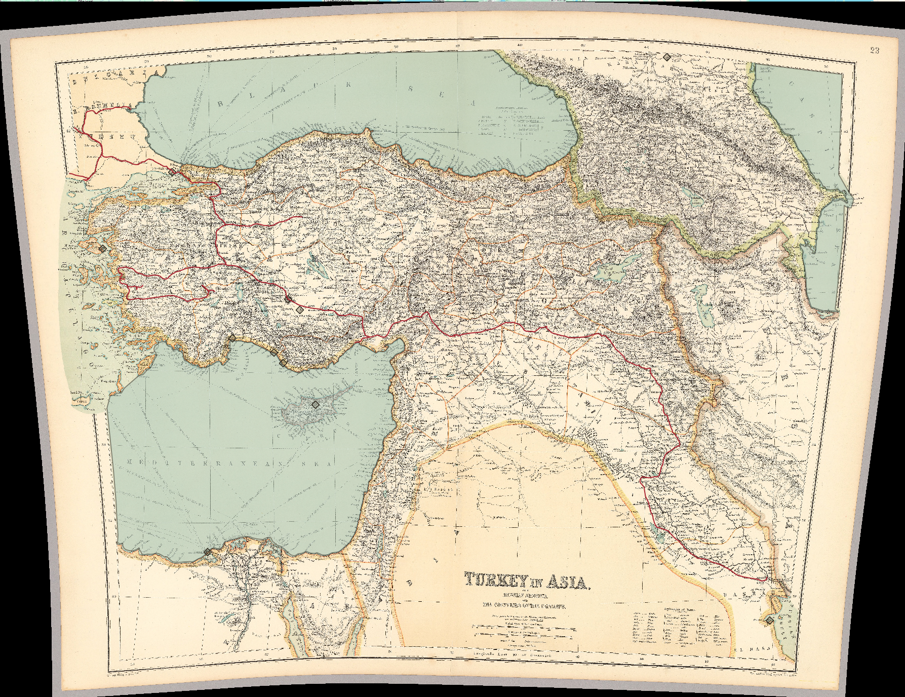
Excluding overcomplicated processes such as hypothetically placing down a bajillion pins to outline the three sea’s pictured inside my map from the perimiters of ‘difficult to assign vector categories’, there are two issues that I noticed over the course of this project. Firstly is something that I see as blindingly obvious, islands, exemplified most obviously by Cyprus. Is it possible to create a zone/zones inside a polygon that are not subject to it’s influence? I don’t know, that’s why I brought it up. Second is the map legend, how could this be vector categorized? Can it be vectored? Possibly if I had to much time on my hands and the line function, but this is unrealistic and not something I think the line function was made with the intention of being used for.
2. What other attributes (aside from name) do you think would have been appropriate to add to your vector dataset?
Since I used my point function to designate several cities on this map, I think that population could be a helpful addition if someone was interested in knowing more about the location. Also with the line function that I used to emphasize the railroads that were marked on the map at this time, I think it would be helpful to list how many miles are covered between every branch, especially since this poor map is so warped. Same thing goes for the polygon function I used to outline the Black, Caspian, and Mediterranean sea’s, square mileage or something of the sort I guess.

3. Did you detect any spatial relationships when digitizing your map that you would not have otherwise? Did you see your historical map in a new way? If so, how?
On my last task in this project of tracing the railroads throughout Turkey, I began to notice that they often went through the cities I had previously marked using the point function as my first step. It seems stupidly obvious that I’m now saying it out loud, but there were multiple cities I had randomly placed to get a feel for the function and the railroad happened to connect to them, that is all the justification I can give as a retort. It helped me conceptualize how easy it had become to travel, the spreading ideas and culture could flow smoothly using modes of transportation, like water in a river.