
The Dust Bowl was an event that impacted Central and Southern States during the 1930s. It has been attributed to a number of different causes, including the over cultivation of land during droughts.
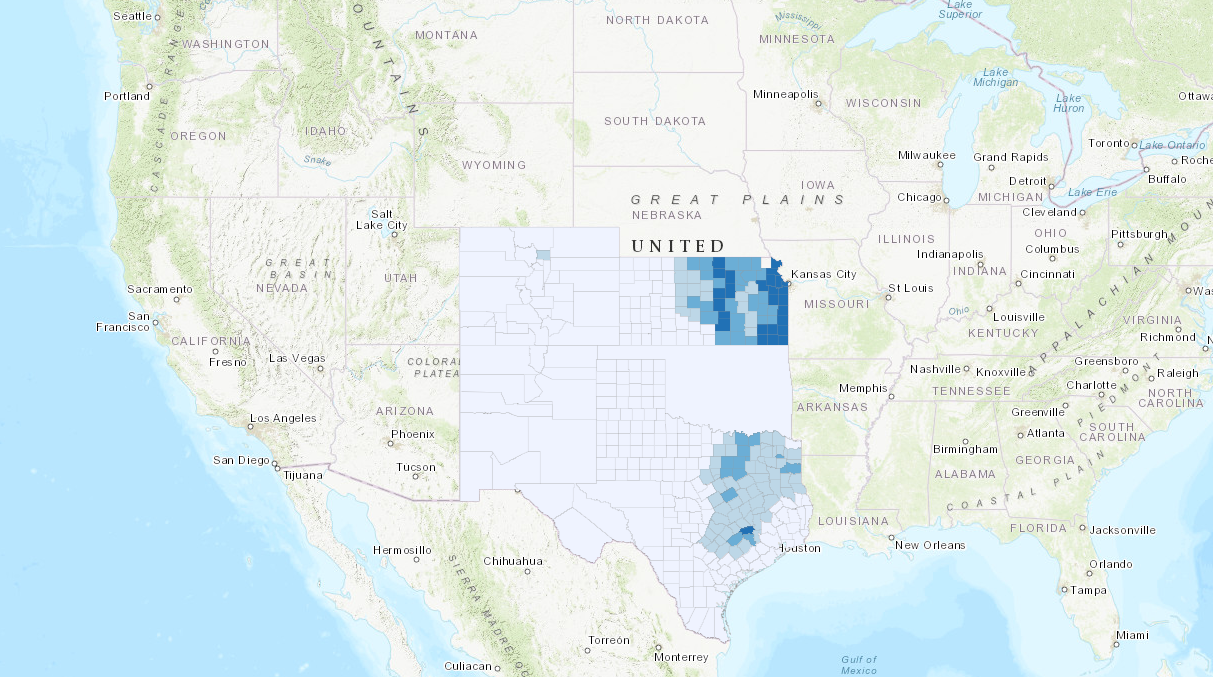
This is a map of the total cultivation of land in 1880 in the states most impacted by the Dust Bowl. Land Cultivation is primarily centered around eastern Kansas and eastern Texas.
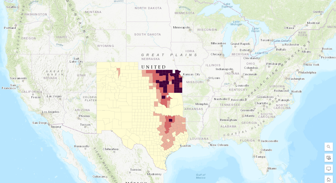
This is a map of the total cultivation of land in 1900 in the states most impacted by the Dust Bowl. Land Cultivation has expanded to include regions of central Kansas and central Oklahoma, while the area of Texas has widely remained the same, but the amount of cultivation in each individual county has changed
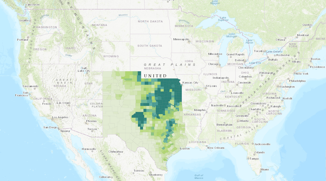
This is a map of total cultivation of land in 1940 in the states most impacted by the Dust Bowl. Cultivation has further expanded to include most of Kansas, Oklahoma, and eastern and central Texas. It has also more heavily expanded into Colorado and New Mexico.
I think this map helps to prove the theory that land cultivation accompanied by droughts helped contribute to the dustbowl. There is a definite increase in land cultivation across this area, and over cultivation accompanied by abnormal weather conditions can be a recipe for disaster in agricultural areas.
Got it.