
In Outline Map of Chase Co. Kansas, 1901, proposed by the Northwest Publishing Company, land appears as if it is easily divided and controlled. The map itself gives the audience the idea that the rural western states are under the domain of man. The precise tooling required used to separate the lines down into individual sections give the viewer the idea of an urban environment in a way. The Homestead Act of 1862 gave heads of households 160 acres of land out in the rural states out west. The act itself was meant to help incentivize people to move west and use the millions of acres available.
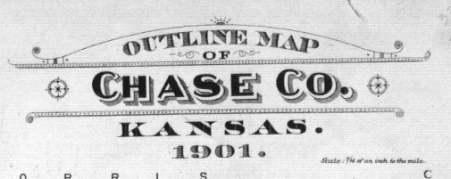
The map appears as a simple yet detailed display of the county lines, infrastructure, and nearly every aspect of the mapped area down to the smallest creek crossing. But the map itself can be seen as a primary source from the era to depict how confidently geographers and cartographers compartmentalized and dedicated land that was available.
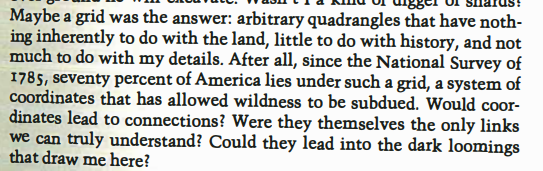
Land and borders were no longer determined by creeks, railroads, or even topography. This is seen in PraryErth by William Least Heat-Moon.
Land had become a commodity and a weapon during the time of the creation of the map of Chase County. It was commodified in the way that appeared simple and monotonous enough for Americans to relocate themselves in rural areas like Chase County. The Homestead Act was also utilized as a weapon against the native population in the area.
The native population surrounding rural communities like Chase County did not view land ownership, nor land as something to control or take dominion over. As seen in multiple sources, including A Topographic Map of Words Parables Of Cartography In William Least Heat-Moon’s PrairyErth by O. Alan Weltzien. Weltzien’s writings regard parts of Heat-Moon’s book regarding the differences in native ideas of land versus colonial America’s policies. Both pieces of writing can be seen to support the idea that policies like the Homestead act of 1862 was a method to remove natives by encroachment.
The Map of Chase County is a display of America’s ideas of domination over the land. The reasoning behind the “crossings” on the map are used to incentivize settlers, reduce land to a commodity, and weaponize the land to defeat an enemy with different beliefs.
Plat book, Chase County, Kansas – 2
A Topographic Map of Words Parables Of Cartography In William Least Heat-Moon’s PrairyErth: Alan Weltzien
PrairyErth (A deep map): William Least Heat-Moon
Nicely done Sam. You’ve successfully interwoven all three materials into an overarching…reflection? Argument? Somewhere in the middle? The format doesn’t much matter to me as long as its clear, concise, and grounded in evidence. I good first effort.
You’ve tagged your post (good), don’t forget to categorize it too.