
Simon Winchester, 2001, The Map That Changed The World: William Smith and the Birth of Modern Geology
The industrial revolution and its benefits have been fantastic for the cartographic race. With the rapid advancement of expansion and industry in Great Britain, it is no surprise that every aspect of society was altered. The cartography process saw a revolution in its sense through the booming market needs for coal and transportation. The deviation from the trodden path by cartographer William Smith created innovation in how maps were created and what maps measured.
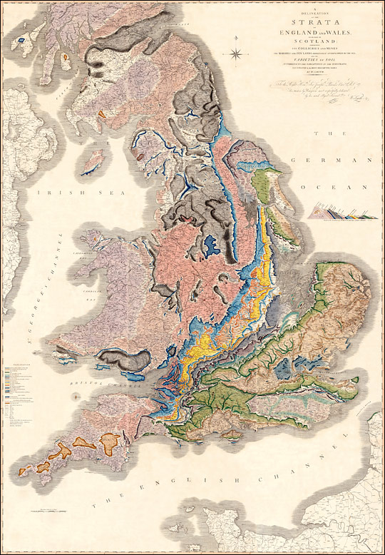
- – William Smith, Geological Map of England and Wales and Part of Scotland, 1815
Smith’s map was geologic. One of the purposes of the was to give details regarding possible transportation routes for the rapidly changing coal industry. His discoveries as a young surveyor led to his idea of “geological succession.” Smith’s process involved aspects of geology that were often disregarded. Many have theorized about the fossils found within stone. Smith looked further into the information that the fossils in the stone and dirt could provide. Both the Industrial Revolution and the Enlightenment contributed to Smith’s research. The benefits Smith was able to provide to the highest bidder allowed his discoveries to revolutionize cartography and geological study in Britain.
“Geographic Succession” is the process of dating fossils on Earth to put the stones in chronological order. The benefits of geographic succession allowed canal planners and railroad planners to place their routes on the strongest or densest ground to prevent catastrophes.
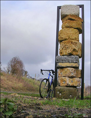
- ©2007 analogueandy
The picture above is similar to the process Smith used to determine the ages and succession of stone.
Smith’s geological map carries an argument about the significance of considering more than what is visible right in front of us. The map vividly exhibits the diversity of geological features across England. Many people during the time of its creation were skeptical about its importance, failing to recognize the critical role it plays in planning essential infrastructure. Building rail tracks, for instance, requires much more thought than just laying them haphazardly. The map was created during a time when labor and workers were in high demand, and people were forced to take up professions in the industry. Respect for history and knowledge of the Earth’s formation became even more important.
Simon Winchester, The Map That Changed The World: William Smith and the Birth of Modern Geology, 1st ed. (New York: HarperCollins, 2001)
Michon Scott, “William Smith (1769-1839),” NASA Earth Observatory, NASA, May 8, 2008, https://earthobservatory.nasa.gov/features/WilliamSmith.
William Smith, A New Geological Map of England and Wales With The Inland Navigations exhibiting The Districts of Coal and other Sites of Mineral Tonnage, 1828, “William Smith’s Maps – Interactive,” http://www.strata-smith.com/map/
In general, nicely done Sam. I really like the conversational approach to this essay, which still brings in ONE of the maps and both of the readings. Correction: its called “faunal succession”. What its lacking is integration of one other map layer from the GIS. It wouldn’t be hard to do so, and this formatting and approach can work for future weeks.
Dont’ forget to categorize, not just tag, your posts. Keep it up!