
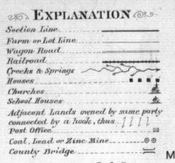
I noticed a few things when I first took a look at this map. I notice it is an outline of Chase County which is located in central Kansas. It was created in 1901 and looks to be owned by the Warren Mortage Group. When I realized this map was either created or sponsored by a mortgage company a lot more really stood out to me. The key includes things like houses, post offices, and churches. A mortgage company is obviously trying to sell and promote areas in Chase County to new or potential buyers.
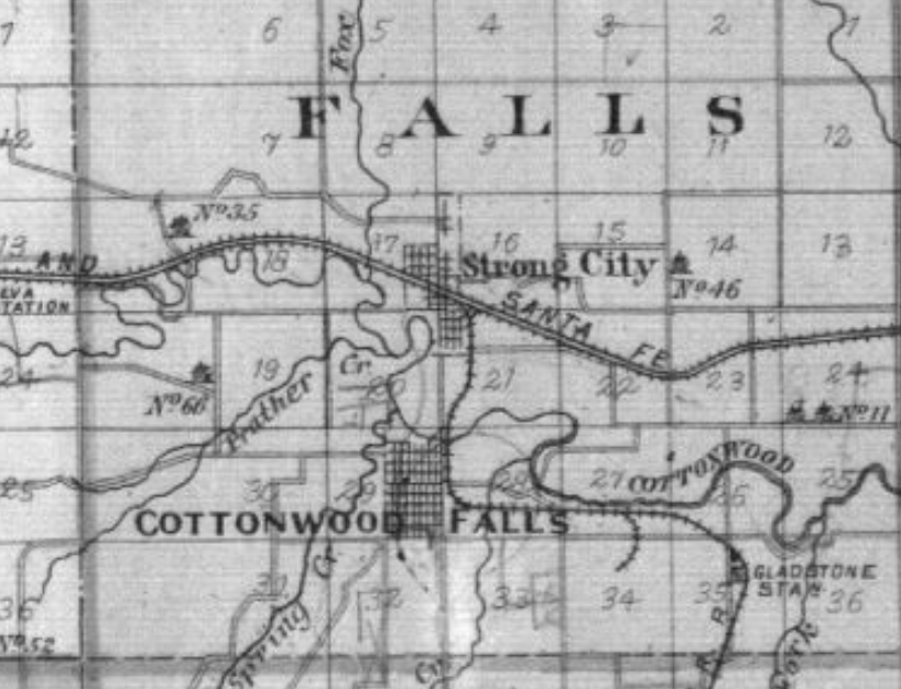
Westward expanision was easier than ever in 1901 and this map shows that. I think the mortgage group is trying to use the map to show what areas were heavily populated and what they had to offer. For example, Cottonwood falls looks to have tons of habited areas. That can be shown by looking at the map and noticing all the figures placed there. I also think the railroad going through this area further strengthens that this was a heavily populated spot in Chase County.
I think this map could further convey its message by possibly showing a prediction of what this area is going to look like. It could also show suggestions from the Warren Mortage Company on what areas they think would be good to buy property.
This is a decent start. You’ve done a nice job of examining some cartographic and non-cartographic elements of one of the maps.
In other words, you’re drawing on one (of the three) resources for the week and you’re making a discursive claim drawing on your reading of the maps.
I’ve never seen a perfect first blog, however, and the biggest issue with this one is that it doesn’t draw on the second or third reading at all. The goal is to put the maps into conversation with one another. What do they reflect? Are they similar? Different? We discussed this in class – but you can think of these blogs as mini-essays to begin fleshing out some of your thoughts.
For any post, the best strategy is to think of the resources in the following order 1. Read over the resources (including the maps) 2. Think about what connects them (discursively)? In other words, what issue/problematic/questions unite them? This will be the focus of your blog. 3. Then, explore how the maps support or challenge that issue.
Keep it up!