Marie Amelse Blog Post 1: Chase County

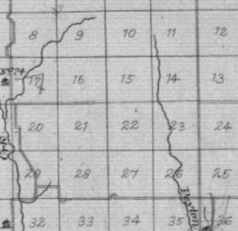
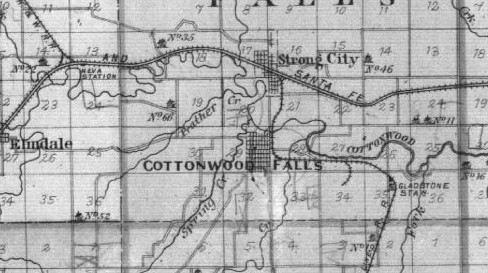
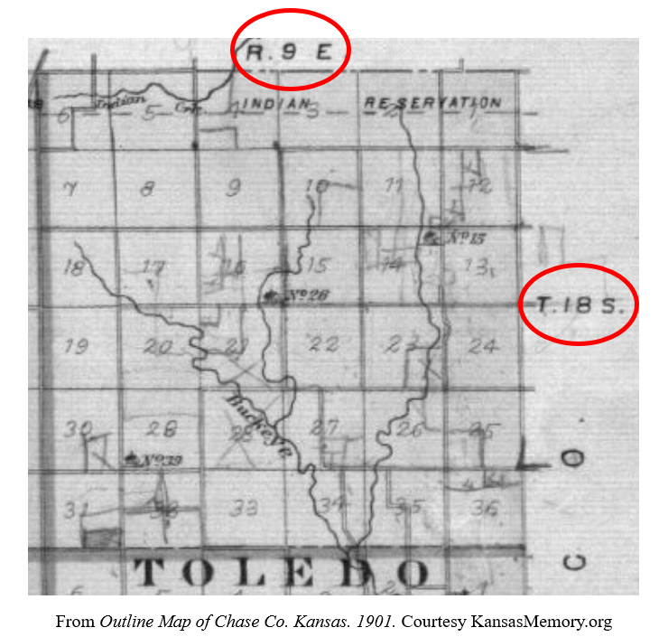
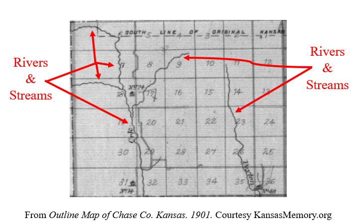
This plat map of Chase County, Kansas shows different areas of land mapped out in almost all identically sized plots of land, based on latitude and longitude. If you were to go one and view all the maps in this collection you would find how this cartography set up different towns, which are not all identical in land plots, but varying sizes based on who owns the land.

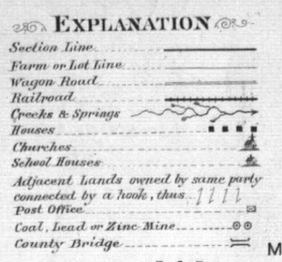
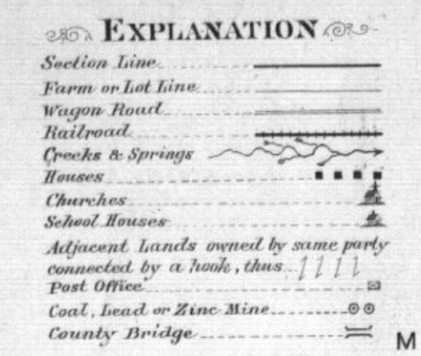
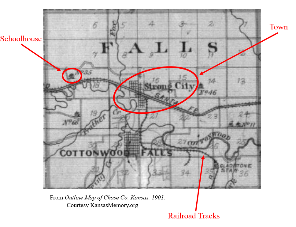
This plat map contains many silences in the environment that is being mapped for example the Flint Hills encompass Chase County and therefore more topography elements than just creeks and springs might be applicable to any type of mapping of this region. Instead, this map focuses more on man-made objects or concepts such as churches, lot lines, and mines, as shown on the symbols key, or “Explanations.”

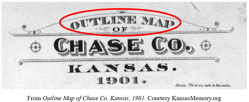
Outline Map of Chase Co., Kansas. (Minneapolis: Northwest Publishing Co. 1901)

In the upper right-hand corner of this map, it is shown that it seems the “Warren Mortgagee Company” owns this map, they might not have been the creators of this map but did use it in some capacity. The silencing of the topography of this map would benefit a mortgage company in that prospective owners might not be aware of the type of plants and hills that occupy this land, as the Flint hills are relatively hard to cultivate. This information would surely deter a farmer from attempting to seek a mortgage company’s help.

William Least Heat-Moon wrote in PrairyErth, ” Maybe a grid was the answer: arbitrary quadrangles that have nothing inherently to do with the land,”, Heat-Moon is contemplating how we could possibly accurately represent the land, how we should represent the land. How could we communicate a location based solely on natural landmarks? Still, a grid feels so disconnected from the land. Later in PrairyErth, Heat-Moon includes a parable about how differently a place could be represented.

William Least Heat-Moon, PrairyErth (Boston: Houghton Mifflin, 2001), p. 16.

As opposed to a grid-type of the map, Heat-Moon shows a Native American interpretation of the land as a moving breathing thing, that was the sum of all it represented, not just a seemingly 2-dimension object. That it in no way could be put into simple boxes and passed off as an unmoving entity,

Declan Dunham Blog Post 1: Mapping Chase County, Kansas

The Outline Map of Chase Co., Kansas. 1901, and the PrairyErth map both convey the idea of population. Both maps attempt to increase the population of Chase Co. However, they attempt this in separate ways. 

The Outline Map of Chase Co. highlights the theme of population by identifying important markers that would provide potential settlers with necessary information. As you can see below, these include Churches, Schools, Post Offices, and much more. These locations provide useful information to potential settlers as many of them are families.  

Outline Map of Chase Co., Kansas. 1901. Kansas Memory, Northwest Publishing Co

However, three specific designations truly share the Map’s argument. These are the Lot Line, Wagon Road, and Railroad. The Lot Line shows all available plots of land in Chase County. Represented as a grid, it is evident that the map makers are highlighting the vast amount of land there is to settle on.  

Outline Map of Chase Co., Kansas. 1901. Kansas Memory, Northwest Publishing Co.

In the second map, PrairyErth, we see Chase County in a new way. We see this land as a group of people. In this map, we are shown quotes from those who live there. This map illustrates the beauty as well as what their culture, specifically farming, means to them.  

William Least Heat-Moon, PrairyErth (London: Andre Deutsch, 1991), 5

Overall, both of these maps promote Chase County, Kansas in different ways. The Outline Map of Chase Co., Kansas promotes Chase County by highlighting its economic capabilities. The author of this map was the Warren Mortgage Company. As a mortgage company, Warren produced this map specifically to generate wealth and increase population. This is why the elements of the map illustrate information that is beneficial only. 

In the second map, the promotion of Chase County stems from the people. This map is a much more personal and deeper map. It illustrates the beauty of Kansas and its culture while showcasing the struggle of what it means to live there. Contrary to the Warren Map, this map is not about profit. It is mapping the culture and history of Chase County.  

Gabe Murphy Blog Post 1: Chase County, KS

“Plat book, Chase County, Kansas – 2,” Kansas Memory, Northwest Publishing Co, 1901, https://www.kansasmemory.org/item/209375/page/3.

As I began to look over sources laid out for this week’s post, the map above seemed distinctively simplistic. If I were to lay down a map, and ask a class the easiest way to divide a map, this would be it. Taking an entire county (relatively square itself), and dividing it into 16 squares, broken up into 36 squares each, amounts to a total of 576 different plots of land–in the simplest manner. Easy, yet effective. But how come?

William Least Heat-Moon, PrairyErth (London: Andre Deutsch, 1991), 12. https://steppingintothemap.com/mappinghistory/wp-content/uploads/2018/01/P-William-Least-Heat-Moon-%E2%80%9CFrom-the-Commonplace-Book-Crossing%E2%80%9DPrairyErth-Houghton-Mifflin-2001.pdf.

In the midst of that, I stumbled across this passage. 60 years following the production of the first map pictured, Robert Baughman stated the purpose and effectiveness of the square plotting: survey and sale. Further taking into account the quick timeline noted by Baughman, the map’s purpose is concluded. First and foremost, it was to take the Indian land from underneath their feet, and in that be able to sell it to settlers looking to expand west. 

Included in the map, located in the top left corner, is the key: listed below.

“Plat book, Chase County, Kansas – 2,” Kansas Memory, Northwest Publishing Co, 1901, https://www.kansasmemory.org/item/209375/page/3.

Again, this is very simple. It noted farmland, roads (wagon and rail), water sources, and public buildings (churches, schoolhouses, and post offices). Given this, as well as the stamp of Warren Mortgage Company in the top right corner, it is easy to say this map was produced for selling plots within Chase County, KS. The audience was settlers; not natives of the land, but those of the US seeking expansion. This map would be horrific to use on the ground, though. It is a comprehensive view from above, with little real world application of the usual purpose of maps: guiding. There are little landmarks, and towns are nothing more than shaded areas hiding beneath other features. Instead of guiding, this map was created with the intent of selling land–which it appears to have been very successful at doing given the 1961 account of Robert Baughman in Heat-Moon’s PrairyErth. This is nothing more than a template, created with an intent for future development.

Sam Ellerbeck Blog Post 1 : Chase County, Kansas

The Outline Map of Chase Co., Kansas. 1901 appears to be a type of reference map, as main routes, railroads, streams, and locations are depicted. In one sense, these aspects of the map help to highlight important modes of travel in Chase County, offering some degree of interconnectedness between the locations shown. Other than this, however, the map maker does not include much detail in terms of landscape and topography. In fact, most to all of the land shown is void of any detail, with no depth or significant attributes present. This may have been used as a tactic to mask the true terrain of these areas.

Inconsistencies in detail, where transportation routes and main creeks are shown, but land is not well depicted. From Outline Map of Chase Co. Kansas. 1901. From KansasMemory.org.

This map had been produced by a mortgage company, which must have been in attempts to sell parcels of land to potential owners. It seems that this map was intended to entice farmers to settle here, given the depictions of significant modes of travel and resourceful water networks, both of which would be of value for agricultural purposes. Additionally, the square lots and their well-defined boundaries offer more reason to assume that this mortgage company had motives to sell land.

Well-defined plots of land in Outline Map of Chase Co. Kansas. 1901. From KansasMemory.org.

The map clearly creates the message that there is a plethora of land that is primed and ready for agricultural use. Untold in this map, however, is the true reality of the terrain. William Least Heat-Moon, in his book PrairyErth, highlights the endless prairies and vast hills that cover the grounds of Chase County. Heat-Moon’s extensive analysis is heavily contradictory to the intentions of the mortgage company, which may have tried to deceive farmers into purchasing land that is not well equipped for agriculture.

To better convey the reality of the landscape, the map maker should have added some sort of topographical element to offer some detail as to the land’s elevational changes. Additionally, borders that depict the boundaries of the vast prairie biomes would be insightful for potential land buyers. Unfortunately, however, there was clear intention to cover these features for profit, where the most pronounced plot line boundaries are inherently deceptive.

  • Heat-Moon, William L. 1991. PrairyErth. Houghton Mifflin Company. pp. 3-18.
  • Outline Map of Chase Co. Kansas. 1901. Plat Book. https://www.kansasmemory.org/item/209375/page/3

Isabel Blackford Blog Post 1: Mapping out Chase Co. Kansas

Both of the maps given seem to have been made for the purpose of settlers who have come to Kansas in the hopes of settling the area and farming the land. PrairyErth: (a deep map) by William Least Heat-Moon maps out the terrain with much more detail, telling others what to bring and describing the land how it appears as in real time. The Outline Map of Chase Co. Kansas. 1901 describes the layout of the land from a birds eye view in order to present where certain landmarks are in comparison to others with the purpose of showing quite literally an outline of Chase County Kansas circa 1901.

Since the Outline Map of Chase Co. Kansas. 1901 is an outline, it does not show Chase County in much detail outside of what is included in the legend of the map and even then there is no further descriptors outside of the symbol placed on the map.

However, Heat-Moon in his book describes how dense the grassland is, along with how barren the landscape is due to its lack of development. The harshness of the environment is described as much different than what the author or the intended audience has ever experienced, warning the settlers to be prepared. There is a town shown in the Outline Map of Chase Co. Kansas. 1901, Cottonwood Falls, which is probably the part of the map with the most detail due to the fact the author was most likely trying to draw people to Chase County to buy the empty lots of land there and make it seem like a less daunting task to develop.

The Outline Map of Chase Co. Kansas. 1901 acts as a visual aid for the layout of Chase County, Kansas in the early twentieth century showing where landmarks are with a legend, Heat-Moon’s book provides the details of what it was like to be actually there and how the environment was alike and different from what the author/audience knew. The Outline Map of Chase Co. Kansas. 1901 is clearly a reference map, showing the geographic area of Chase County, Kansas along with labeling railroad lines, lot lines, creeks, churches, and wagon roads. The book by Heat-Moon gives more of a background for the territory that makes up Chase County, Kansas in much more detail to its audience providing a description that is able to create more of a visualization of the area than that of the Outline Map of Chase Co. Kansas. 1901, a reference map.

Wyatt Greco Blog Post 1: Chase County, KS, as a Grid Map

Northwest Publishing Co.’s 1901 Plat Book of Chase County, Kansas, includes an outline map of the entire county. As evidenced by this map’s key (pictured below), human creations are prioritized over natural features.

Outline Map of Chase Co., Kansas. 1901. Northwest Publishing Co., Minneapolis. Retrieved from Kansas Memory.

Structures such as roads, houses, and churches are all identified with labels on the map. Only one category of natural features, labeled as “Creeks & Springs,” are included. Given that water is essential to settlement and agriculture, this inclusion fits with the generally human-focused purpose of the map. However, a view of the entire map reveals a more specific proposition.

Outline Map of Chase Co., Kansas. 1901. Northwest Publishing Co., Minneapolis. Retrieved from Kansas Memory.

The above map is dominated not by buildings or roads, which would be easily visible to those actually standing on the ground in Chase County. Rather, the most prominent characteristic of this map is the grid lines. This grid denotes the surveying of Chase County, which divided the area into sections and property lots. Given their mostly equal size and straight borders, one can infer that mathematics (not, say, topography or soil fertility) primarily informed the division of the land. Though the grid system is purely the creation of the human mind, the map nonetheless proposes that these lot and farm distinctions exist where they do. Unlike buildings, mountains, roads, or rivers, property only really exists on paper. And yet, through mapping, gridded property lots become a reality which binds society and individuals.

In his book PrairyErth, William Least Heat Moon contemplates the grid system as a framework for his literary “deep map” of Chase County:

William Least Heat Moon, PrairyErth (Boston: Houghton Mifflin, 2001), p. 15.

Heat Moon points out that the coordinate system is detached from land and history. While this detachment could allow broad room for Heat Moon to structure his exploration, it also alludes to an important reminder about mapping. Maps need not be strictly beholden to physical subjects—whether they be created by humans or nature. Instead, maps can impose ideas or legal conventions onto physical space. In the words of Heat Moon, maps like the one explored in this post have “allowed the wildness to be subdued.” Much is left out of the 1901 Outline Map of Chase County, and this is deliberate. The purpose of the map is to portray how the land has been organized and divided to facilitate ownership, not to recreate or represent the natural, or even certain aspects of the human, world.

Payton Mlakar Blog Post 1: Mapping Chase County, Kansas

The Outline Map of Chase Co. Kansas. 1901. seems to be a reference map which proposes an “outline” of the land organization and settlement patterns of Chase County, Kansas. With the map’s title beginning with “outline,” the mapmaker clearly did not intend to provide the viewer with a comprehensive guide to the landscape of Chase County and instead intended to provide limited information about the landscape and the settlements in the county.

The map primarily focuses on depicting human-made features such as towns, schoolhouses, and railroads. . .

. . . as well as features that humans have imposed on the landscape such as the clearly marked Township and Range lines of the Public Land Survey System (PLSS) that pervade the map.

The mapmaker largely omitted depicting most natural terrain and vegetation on this map in favor of depicting these human-made and human-imposed features. This indicates that the mapmaker intended for this map to help people buying land in Chase County determine where they might like to purchase land and what amenities may be near that area.

Despite omitting most natural features, this map does depict streams and rivers that run through the county.

Having a nearby water source to provide water for human habitation, livestock, and crops would be an important consideration for a prospective landowner. As a result, this map depicts water sources throughout the county to better serve its purpose of providing people buying land in Chase County with an outline of the county’s layout to better inform their purchase.

In his book PrairyErth: (a deep map), William Least Heat-Moon provides readers with an outline of Chase County with a simple grid of twelve blank squares each representing one section of Chase County.

Throughout the book, Heat-Moon fills in these empty spaces by describing the minute details of the landscape of Chase County as he creates a “deep map” of the area.

Prospective landowners viewing the Outline Map of Chase Co. Kansas. 1901. similarly used their imagination to fill the “empty” and featureless natural landscape the map depicts with the plans they had for the land they sought to purchase.

The portrayal of plots of land as blank spaces allowed viewers to imagine the farms, ranches, businesses, or houses they planned to construct on a “blank slate” of land in Chase County, creating their own imaginary “deep map” of part of the county.

Test post

You should review the “how to write a blog post” page before you begin. Probably helpful before you read the assignments and look at the maps too…

Here is some insightful thing I want to say about mapping based on 1. readings and 2. mapping products. (Imagine I’m 400 words).

Oh yeah, and here is an image I’m using for support (think of this as visual quotation marks). It can be at the beginning, middle, or end of your post. The format and structure is up to you!

…which I want to compare to this one…

Don’t forget to cite your work!

FINALLY, don’t forget to categorize your post as a “weekly blog post” and add the tag “weekly blog post” before you “publish.”

css.php